All along the hillside are the “poor man’s umbrella” plants. There are 40-50 species of Gunnera. or Poor Man's Umbrella, in Costa Rica. It has a thick stem that can be up to a foot long, and heart-shaped, toothed leaves. The leaves are very large, from 3-6 feet in diameter.

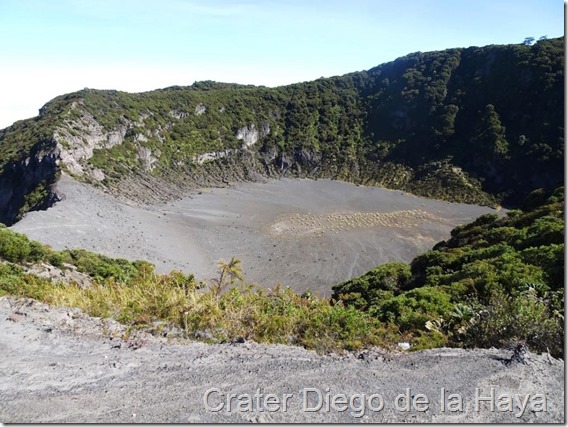
The first viewing area is Crater Diego de la Haya which is 1650 feet in diameter. The lake has reformed many times but is dry now.

Irazú Volcano is Costa Rica’s tallest volcano at 3,432 meters (11,260 feet). The main crater is 2450’ in diameter! During certain times of year when it is rainy, there is a beautiful blue-green lake at the bottom.

The last time Volcán Irazú awoke was in the first half of the 1960’s, when, for four years it showered the residents of Cartago and San José with ash, clogged the air with smoke, and sent glowing boulders rolling down its sides. It’s last eruption was in December of 1994. There is also a huge ash field along the caldera of the volcano we were able to walk across.


On a small road above the volcano is a volcanic anti-ballistic shelter built in 1964 to monitor the volcanic activity. We were able to climb up to the top and look over the volcano. We were told that on a clear day you can see the Caribbean to the east and the Pacific to the west. Clouds prevented seeing either!


Irazú Volcano is Costa Rica’s tallest volcano at 3,432 meters (11,260 feet). The main crater is 2450’ in diameter! During certain times of year when it is rainy, there is a beautiful blue-green lake at the bottom.

The last time Volcán Irazú awoke was in the first half of the 1960’s, when, for four years it showered the residents of Cartago and San José with ash, clogged the air with smoke, and sent glowing boulders rolling down its sides. It’s last eruption was in December of 1994. There is also a huge ash field along the caldera of the volcano we were able to walk across.


On a small road above the volcano is a volcanic anti-ballistic shelter built in 1964 to monitor the volcanic activity. We were able to climb up to the top and look over the volcano. We were told that on a clear day you can see the Caribbean to the east and the Pacific to the west. Clouds prevented seeing either!


From Irazú we headed back down the mountain and on to Guayabo National Monument. Google maps said 1-1/2 hours for the 24 mile drive … not possible!!! It took us over two hours!
We did make a stop to watch some para-gliders, but only spent about 10 minutes doing that. It was really cool. We saw them flying from a distance then came to the top of the hill and there was a huge parking area and more than a dozen folks out riding the thermals!


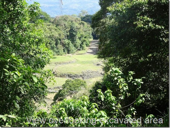
Legs stretched, on the road again to Guayabo National Monument. We were able to have a guide take us through the ruins. It is one of the largest and most important archeological finds in Costa Rica. Guayabo National Monument is likely to have been the residence of approximately 10,000 people about 3,000 years ago.

We did make a stop to watch some para-gliders, but only spent about 10 minutes doing that. It was really cool. We saw them flying from a distance then came to the top of the hill and there was a huge parking area and more than a dozen folks out riding the thermals!


Legs stretched, on the road again to Guayabo National Monument. We were able to have a guide take us through the ruins. It is one of the largest and most important archeological finds in Costa Rica. Guayabo National Monument is likely to have been the residence of approximately 10,000 people about 3,000 years ago.

It was a bustling city at around AD 800. Archeologists believe the site was populated from 1000 BC to 1400 AD. For no known reason, the city that many believe was a key regional center for politics, culture, and religion became a desolate landscape.


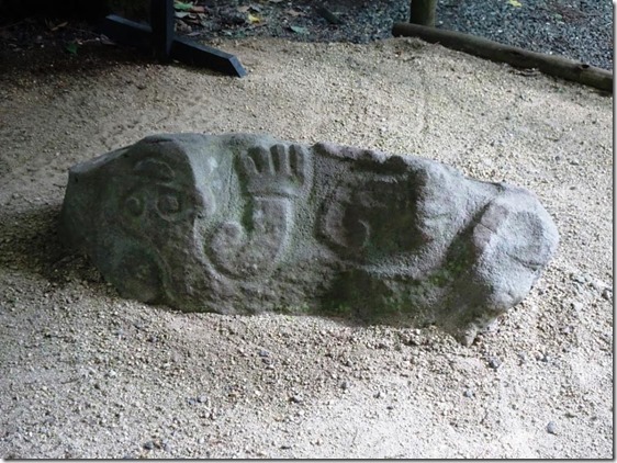
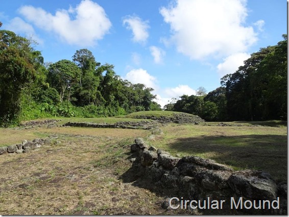
They have discovered petroglyphs, tombs, the remains of circular mounds believed to be the people’s residences, cobblestone pavements, and sophisticated aqueducts. It was believed that conical structures made from balsa wood were erected on the top of the mounds.


Martin, our guide, spotted a Sunbittern as we went by the largest of the circular mounds. He said they are migrating and we were lucky to see it.


We enjoyed our visit to Guayabo and were glad we made the trip – even if Gary had to drive on very narrow, winding roads that went from pavement to gravel with little warning. It was after 2pm so we stopped at Los Tucanes Soda (café) for lunch on our way home. Martin, our guide recommended it and we were not disappointed. The food was good – large portions – and reasonably priced.


We enjoyed our visit to Guayabo and were glad we made the trip – even if Gary had to drive on very narrow, winding roads that went from pavement to gravel with little warning. It was after 2pm so we stopped at Los Tucanes Soda (café) for lunch on our way home. Martin, our guide recommended it and we were not disappointed. The food was good – large portions – and reasonably priced.

Then back on the road for our 2+ hour drive to San Jose. We did spot this fun little snack trailer on our way back but we were TOO full to stop.


We had a quiet evening back in our condo as we wrap up our stay in San Jose. Tomorrow we are on our way to Uvita.

No comments:
Post a Comment