Travel with Tobey and Sue

Travel with Tobey and Sue
Tobey and Sue in Africa

Saturday, February 20, 2021

Feb 18, 2021 - Tombstone to Chiricahau National Monument, Arizona

Well the weather didn’t get as cold overnight as predicted – only 30! We heated our rice bags and popped them at the foot of the bed so we were pretty snug all night. Yes, we are sissy campers.

We had sunny skies as we headed back into Tombstone to walk around the historic district one more time. At 9:30 in the morning it was pretty quiet.
There were some folks going for a stagecoach tour through town.
Tombstone was originally the Cochise County seat. The original courthouse is now a museum since the county seat was move to Bisbee.
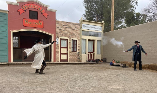
Ed Schieffelin came to this area in 1877 searching for silver. Soldiers from Fort Huachuca warned him that the only thing he would find was his tombstone because this area was patrolled by the Apache warrior, Geronimo. Ed did find silver and jokingly named his claim “Tombstone.” Other prospectors soon followed and the town of Tombstone grew to be one of the greatest silver camps in the west.

We were lucky enough to go past the town library and I was able to post yesterday’s blog we before heading east to Chiricahua.
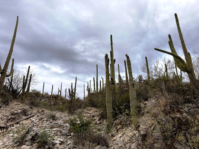
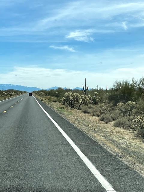
About 75 miles and a couple hours later (after a lunch stop!) we arrived at Chiricahua National Monument. This area is called a “sky island” because it is an isolated mountain range rising above the surrounding grassland sea. The Chiricahua Apache called the pinnacles “standing up rocks,” and you will see why later. 

Our first stop was the visitor’s center to get a map and hiking guide. The ranger gave us a couple suggestions so we were off to the end of the road and the Massai Point Nature Trail.
The scenic Bonita Canyon Drive is eight miles and wound through oak, cypress, and pine forests. When we got to the top, there was an amazing view over the Rhyolite Canyon and valleys.
The pinnacles originated 27 million years ago when eruptions from the Turkey Creek Volcano spewed ash over 1,200 square miles. The superheated ash particles melted together forming layers of gray rock called rhyolite. Cooling and subsequent uplifting created the joints and cracks in the rhyolite. Weathering by ice and water erosion enlarged the cracks. The weaker materials were washed away, leaving the spires, balanced rocks, and other shapes. Some of the formations are named, others are not.


This rock didn’t have a name, but we thought it looked like a sea turtle popping its head out of the water.
Massai Point Nature Trail was about 1/2 mile long and the elevation was 6,870 feet. It was sunny, but chilly, so we wore our winter jackets and hats.
Cochise, a famous Chiricahua Apache chief, often hid in this area of the Dragoon Mountains. He died in 1874 and was buried in a deep grave within the Stronghold. It is said that is followers ran their horses over his grave to erase any trace of it. To this day, it has not been found.
Harris Mountain was named after a pioneer family who died at the hands of Apaches in 1873. They were part of a westward bound wagon train who attempted to take a short cut through the Chiricahua Mountains and disappeared. Several years later, soldiers from Fort Bowie found one of the the Harris girls in an Apache camp in Mexico! She told them what had happened and led them to the spot at Harris Mountain where the family was killed. They found the remaining bones and buried them. A headboard marks the gravesite.

Looking to the northwest we could see the rock formation which resembles a man resting on his back. It is named Cochise Head.
From Massai Point we headed back to the Echo Canyon turnoff to hike the Sugarloaf Mountain Trail. The 1.8 mile trail climbs 470 feet up the mountain reaching an elevation of 7,310 feet. We passed through a small tunnel cut by men of the Civilian Conservation Corps who built the trail.

 
At the summit we came to the fire lookout station which was also constructed in 1935 by the CCC. It is still used today to monitor fire and lightning activity in the area in the summer. Tobey was searching for fires but, fortunately, didn’t spot any!
We both decided the trail was MUCH easier going down! Yes, that is snow on the ground!
The side of the cliff was so white! We don’t know enough about geology to explain it.

The views were spectacular.

After the hike, we headed back down the mountain to the Bonita Canyon Campground where we will stay for two nights. There were some beautiful rock formations we stopped to see along the way back down the hill.
Tomorrow will be the real challenge. We are hoping to complete the Heart of Rocks trail. Leaving from the campground, it will be over 8 miles. No internet service here so we will post later.

Thursday, February 18, 2021

February 17, 2021 - Oro Valley to Tombstone, Arizona

It was a busy day today! We left the condo about 9:15 this morning and headed to Kartchner Caverns State Park. We had an 11:15 tour reservation for “The Big Room” and needed to check in by 10:45. After a quick stop at the grocery store, we made it with a little time to spare.
Because of COVID, the tour is now limited to six people and the park ranger. Before our tour began we had an opportunity to look through the museum. While it isn’t a huge museum, it is very well done. Lots of great displays explaining everything you might want to know about caves! Then on to the tour – and what an amazing tour it was!

Lasting an hour and 45 minutes, the time flew by. Our guide, Jackie, did an great job explaining the history of the cave’s discovery in 1974 and the desire to preserve the cave by the men who found the cave. They kept the location secret for four years because they wanted to maintain the integrity of the eco-system within the cave. The cave became part of the state park under Governor Babcock and and opened to visitors in 1999.

She showed us the different types formations in the cave. We did see some “Fried Egg” stalagmites on the tour. We watched one as the drops were coming down every few seconds which forms wider stalagmites. Slower drops make long, thin stalagmites.
The cave also serves as a “maternity ward” for bats so the “Big Room” section of the cave is closed to visitors from early April when the bats arrive to give birth until they leave with their “pups” to migrate south in September or October.

They haven’t found many bones in the cave, but one they did discover was the “Northrotheriops shastensis” (commonly known as the Shasta Ground Sloth). They sloth is prehistoric, typically roaming woody upland areas between 2 million and 10,000 years ago! How or why they are in this cave has scientists guessing. They were thought to be about 600 pounds! This photo showed where they were excavating some of the bones.

The temperature inside the cave is about 72 degrees year round and there is a series of “airlock” doors to enter the cave which help preserve the humidity levels and keep dust particles out. Cameras, phones, backpacks, purses, etc. are not allowed in the cave to prevent “foreign” objects from falling into the cave or bringing in extra bacteria. As such, the pictures I took were from displays in the museum! It is hard to describe the enormity of the inside of the cave and the different formations!
The “bacon” ribbon formations really did look like bacon!
It was such a great tour.

If you are in this area I highly recommend you go to the Arizona State Parks website and get a reservation to check it out. Since COVID, they have not had tours in the Throne Room or Rotunda and you do need to make reservations in advance.(Adults were $23 per person.)

After our tour we finished going through the museum before making our way on to Tombstone. It was a beautiful drive! This was the view just south of Kartchner State Park.

As we got closer to Tombstone we crossed a creek. I didn’t see a sign so I don’t know what it was called, but it was pretty.

Crazy as it seems, within 15 minutes, the clouds started rolling in and the winds picked up (even though they were strong at Kartchner) so by the time we arrived, it was almost completely overcast! We bundled up with our winter coats, hats and gloves! The wind were gusting over 25mph and temperatures are in the high 40s. While that isn’t “cold”, it certainly wasn’t warm.

We got tickets to visit the O.K. Corral Museum and see Wyatt Earp, Doc Holliday, Virgil and Morgan Earp fight the McLaurys and Clantons in one of the daily reenactments of the “Gunfight at the O.K. Corral” in the Tombstone Theater. Yes, it was kind of cheesy, but what the heck, it was only $10 each! The museum buildings had lots of great displays and information about Tombstone in the 1880s.


We really enjoyed seeing C.S. Fly's Photo Gallery. He had several photos of the Apache warrior Geronimo and historic photos of 1880s Tombstone life. After that we watched the 4pm multimedia history of Tombstone from Geronimo's Apaches to modern time which was narrated by actor Vincent Price. It added another aspect to the history.

It was too cold at 4:30 to do much else in town (and most things had already closed), so we headed out of town about four miles where we are camping for the night. There are five or six other RVs parked nearby. The wind is blowing like crazy and rocking our little house on wheels. The temperatures are supposed to drop to about 26 tonight, so we are hunkering down and bundling up!

We will head back to Tombstone to see a few more of the historic buildings including the 1880s museum of Arizona’s oldest newspaper, the Epitaph, which is still published today. After that, it will be on to Chiricahau.

Tuesday, February 16, 2021

February 16, 2021 - Oro Valley, Arizona

It was overcast and chilly this morning but we had decided to hike to the petroglyphs in Honey Bee Canyon Park so we went anyway. The park is about five miles from our condo and easy to get to. We bundled up with hats, gloves, and heavy coats and headed out.

The trail begins just past the restrooms and follows the Sausalito Wash until it meets the point where the petroglyphs are! We navigated through lots of sand. Even though this trail is in a residential area, the walls of the canyon shielded our view of civilization for the most part. There is plenty of the usual Sonoran Desert vegetation along the trail including many saguaro cactus.

A little over a mile north of the parking area we arrived at the petroglyphs which were created by the Hohokam people over 1000 years ago. There weren’t very many, but it was still fun to see.

We continued past the petroglyphs and went past a dam and watering trough. Apparently, it was placed there by sheepherders in the 1800s.

We kept going, hoping to spot more petroglyphs, but alas, there were none. It was still a beautiful hike and we warmed up long before we finished.


It was 3.4 miles roundtrip for us so a good warm-up for our trip to Chiricahua later this week.

After lunch we decided to drive to Mount Lemmon. The drive along the Catalina Highway is also known as the Sky Island Scenic Byway. The road climbs Mount Lemmon, the highest peak of the Santa Catalina Mountains.

The first few miles of the road are mostly flat. The desert vegetation at the beginning of the route is typical of the Sonoran Desert, but once we began the climb, we saw the hillsides crammed with saguaros.

There were numerous pullouts and vista points along the route up the mountain. They’re all beautiful. Windy Point, about 18 miles into the drive, gave us the view of the Tucson area below.

Millions of years of erosion created a large number of extraordinary stone “beings” known as HooDoos. A local historian explained the name came from early pioneers who saw these rocks emerging from the mist thought they looked like magical beings.

We were amazed at all the formations and loved stopping at many of the pullouts to take pictures.


The weather went from sunny and windy, to overcast and windy, and snow along the road and hills the further up the mountain we went.


While there signs for bears and other wildlife, the only thing we actually saw was a bird!
We turned around at the ski valley turnoff – about 27 miles up the mountain. While the temperatures in Tucson were around 60 degrees, it was probably in the mid-30s at 8000’!!!

The Seven Cataracts are a series of waterfalls along the stream that passes through Willow Canyon, which eventually empties into Bear Canyon near the Seven Cataracts Vista on Mount Lemmon’s Catalina Hwy. One of the definitions of the term “cataract” is a large waterfall. WHO KNEW???? We sure didn’t! It is difficult to see the waterfalls in this picture, but we could see three of them.

Thimble peak is one of four peaks on a ridge which runs from northeastern Tucson into the heart of the Catalinas. Sabino Canyon bounds this ridge on the west side, and on its east side the ridge drops off into Bear Canyon. Before we arrived at the pullout with the signage signally this pointy nub on the left side of the mountain as Thimble Peak, we were speculating what it might be!

The round trip drive was about 125 miles and we arrived back at our condo about 5pm tonight after a busy day. We will have an early start tomorrow heading out to Kartchner Caverns State Park. I’m not sure how much internet service we will have in the next few days, so posts may come in a wave when we return back to Scottsdale!

Monday, February 15, 2021

February 15, 2021 - Scottsdale to Oro Valley, Arizona

In an effort to explore more of Arizona we loaded up the RV and took off today and headed south, leaving our sweet dog, Penny, with our moms. Thank you!!! Since she is getting older and has lost most of her hearing, it is much more difficult for her to travel in the RV.

Our first stop was in Florence, Arizona to see my cousin, Renee. We sat outside and visited for a while when we dropped off copies of our family history books which our grandmother had compiled. Somehow, I ended up with all of the extra copies and she didn’t have one. I hope she has as much fun as I have looking back on relatives – all the way to the 1700s!

Heading south along Highway 79 we passed lots of cacti and even spotted some hawks perched on top of them! There wasn’t much traffic so it made for an enjoyable drive.

We arrived at the WorldMark Resort in Oro Valley early this afternoon and checked into our condo for a couple days. Our friends, Roger and Diane, drove up from Tucson for a visit. We ordered take-out from La Hacienda Family Mexican Restaurant. The food was really good and we had a great time visiting. They recently purchased a Casita camper so we were sharing our VAST knowledge of RVing! (HAHAHAHA!!!!!) Anyway, we had a good time and hope they enjoy their little home on wheels as much as we enjoy ours! We are hoping to share some camping time in the future together.

The weather forecast is much cooler than when we originally planned the trip but still warmer than most of the US so we are not going to complain. (At least, not too much!) We have two nights here so tomorrow we will do a little exploring around the Tucson area.