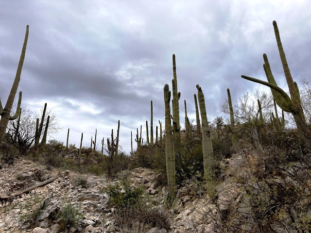
The trail begins just past the restrooms and follows the Sausalito Wash until it meets the point where the petroglyphs are! We navigated through lots of sand. Even though this trail is in a residential area, the walls of the canyon shielded our view of civilization for the most part. There is plenty of the usual Sonoran Desert vegetation along the trail including many saguaro cactus.

A little over a mile north of the parking area we arrived at the petroglyphs which were created by the Hohokam people over 1000 years ago. There weren’t very many, but it was still fun to see.

We continued past the petroglyphs and went past a dam and watering trough. Apparently, it was placed there by sheepherders in the 1800s.

We kept going, hoping to spot more petroglyphs, but alas, there were none. It was still a beautiful hike and we warmed up long before we finished.


It was 3.4 miles roundtrip for us so a good warm-up for our trip to Chiricahua later this week.
After lunch we decided to drive to Mount Lemmon. The drive along the Catalina Highway is also known as the Sky Island Scenic Byway. The road climbs Mount Lemmon, the highest peak of the Santa Catalina Mountains.

The first few miles of the road are mostly flat. The desert vegetation at the beginning of the route is typical of the Sonoran Desert, but once we began the climb, we saw the hillsides crammed with saguaros.
There were numerous pullouts and vista points along the route up the mountain. They’re all beautiful. Windy Point, about 18 miles into the drive, gave us the view of the Tucson area below.


 Millions of years of erosion created a large number of extraordinary stone “beings” known as HooDoos. A local historian explained the name came from early pioneers who saw these rocks emerging from the mist thought they looked like magical beings.
 We were amazed at all the formations and loved stopping at many of the pullouts to take pictures.


The weather went from sunny and windy, to overcast and windy, and snow along the road and hills the further up the mountain we went.


While there signs for bears and other wildlife, the only thing we actually saw was a bird!

We turned around at the ski valley turnoff – about 27 miles up the mountain. While the temperatures in Tucson were around 60 degrees, it was probably in the mid-30s at 8000’!!!

The Seven Cataracts are a series of waterfalls along the stream that passes through Willow Canyon, which eventually empties into Bear Canyon near the Seven Cataracts Vista on Mount Lemmon’s Catalina Hwy. One of the definitions of the term “cataract” is a large waterfall. WHO KNEW???? We sure didn’t! It is difficult to see the waterfalls in this picture, but we could see three of them.

Thimble peak is one of four peaks on a ridge which runs from northeastern Tucson into the heart of the Catalinas. Sabino Canyon bounds this ridge on the west side, and on its east side the ridge drops off into Bear Canyon. Before we arrived at the pullout with the signage signally this pointy nub on the left side of the mountain as Thimble Peak, we were speculating what it might be!

The round trip drive was about 125 miles and we arrived back at our condo about 5pm tonight after a busy day. We will have an early start tomorrow heading out to Kartchner Caverns State Park. I’m not sure how much internet service we will have in the next few days, so posts may come in a wave when we return back to Scottsdale!

The Seven Cataracts are a series of waterfalls along the stream that passes through Willow Canyon, which eventually empties into Bear Canyon near the Seven Cataracts Vista on Mount Lemmon’s Catalina Hwy. One of the definitions of the term “cataract” is a large waterfall. WHO KNEW???? We sure didn’t! It is difficult to see the waterfalls in this picture, but we could see three of them.

Thimble peak is one of four peaks on a ridge which runs from northeastern Tucson into the heart of the Catalinas. Sabino Canyon bounds this ridge on the west side, and on its east side the ridge drops off into Bear Canyon. Before we arrived at the pullout with the signage signally this pointy nub on the left side of the mountain as Thimble Peak, we were speculating what it might be!

The round trip drive was about 125 miles and we arrived back at our condo about 5pm tonight after a busy day. We will have an early start tomorrow heading out to Kartchner Caverns State Park. I’m not sure how much internet service we will have in the next few days, so posts may come in a wave when we return back to Scottsdale!

No comments:
Post a Comment