Travel with Tobey and Sue

Travel with Tobey and Sue
Tobey and Sue in Africa

Tuesday, October 3, 2017

October 3, 2017 - Acadia National Park

Today we entered Acadia National Park at the Hulls Cove Visitor’s Center. After checking in we got information about different hikes in the park. We opted to take  the park shuttle bus to the Cadillac Mountain trailhead to begin our hike.

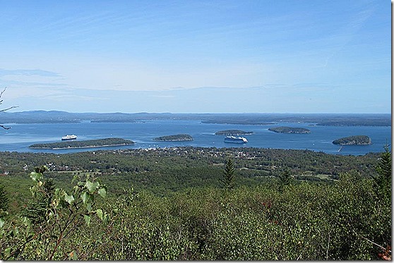
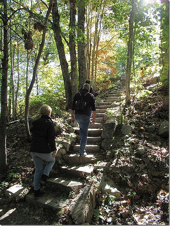
From the trailhead, the route ascends to 1530 feet at the Summit of Cadillac Mountain, the highest point along the North Atlantic seaboard. It is the first place to view sunrise in the US from October 7 through March 6. Since it is only October 3, we didn’t leave early to get to the top to see the sunrise! It is one of over 20 mountains on Mount Desert Island where Acadia is located that were pushed up by earth's tectonic and volcanic forces millions of years ago. Enormous glaciers sheared off their tops, otherwise they would be even higher than what it is today. Our climb began in the forest and went up … and up … and up! The steps were the easy part of the trail! The forest service has done an excellent job marking the trail with the use of rock cairns. They are unobtrusive to the scenery, and along with some blue paint marks along the way, guided us to the top and down the other side.We stopped several times along the trail to marvel at the beautiful landscape. We could see Bar Island and the Porcupine Islands. From left to right they are Bar Island, Sheep Porcupine Island, Burnt Porcupine Island, Long Porcupine Island and Bald Porcupine Island, all located in Frenchman’s Bay. 

There were two cruise ships in today, so the town was probably hopping! We did meet a few people from the ships on the bus back to town.Some of the trees were beginning to show off their autumn colors and it was beautiful to see.After 2.1 miles, we made it to the top! The views were amazing and we stopped for photos before the long descent to the south.Leaving the summit (and most of the forest) behind, we passed the small visitor’s center and started south on the trail to the Blackwoods campground. We could see to the Atlantic and many other islands on the east side of Mount Desert Island. We were amazed at the Maine coastline which is rugged and rocky.The vegetation on the southeastern side of Cadillac Mountain also changed as we continued our trek. The trees were smaller and there were fewer deciduous trees.Along the hike we spotted several different types of mushrooms and wished we were able to identify the different types. The first one made me pause and look for little gnomes or fairies, but I found none!The rest of these mushrooms were pretty good sized!About an hour from the campground where we picked up the bus back to town, we started seeing more trees again and began to wind our way through the forest. Back at the campground we were lucky and only had to wait a few minutes for the next shuttle bus which took us back to town. Our hike today took us 6.53 miles with an elevation gain of 1189 feet.

In town we stopped at Carmen Verandah’s for a bite to eat before taking another bus which would get us back to pick up the car at the visitor’s center. Talk about a weird experience. We all wanted soup – clam chowder, tomato basil or chili. We asked about the size of a cup of soup because in our past experience, the size varies. Our waitress seemed to think we were morons and replied, “a cup is a cup!” Tobey and Bernhard opted for a bowl of soup, while Marlies and I ordered “a cup!”We shuttled back to the park to get the car then headed back to our hotel. After a rest we went out for Mexican food at Jalapenos Restaurant. It was pretty good and after dinner we decided to share a pitcher of margaritas. They were delicious and a fun way to end the evening!

Tomorrow the weather is supposed to be good again, so we plan to drive the park’s Loop Road, take lots of pictures, and do a smaller hike.

Monday, October 2, 2017

October 2, 2017 - Kennebunkport to Bar Harbor, ME

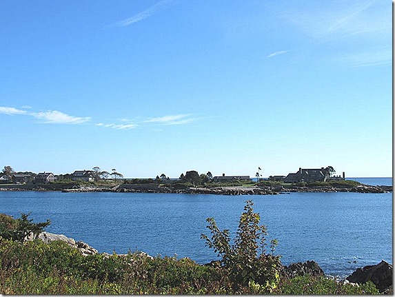
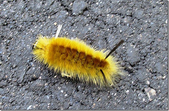
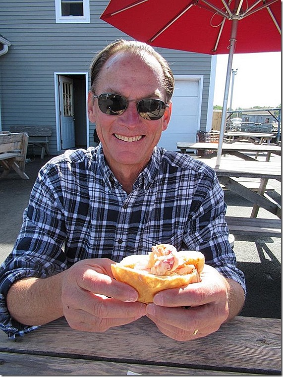
Today we took a walk around Kennebunkport – about 4-1/2 miles! We left our hotel and headed to Ocean Avenue. We passed many beautiful homes and large resorts as we made our way toward St. Ann’s Church. We stopped at one resort to join a wedding in progress where Tobey made friends with the maid of honor. He didn’t bring a gift so we didn’t stay.There was a giant pumpkin among the fall decorations at another spot.Further along the coast we came to St. Ann’s Episcopal Church, an historic seaside chapel. Built in 1887, the  grounds overlook the Atlantic Ocean.  The inside of the church was beautiful with its stone walls and simplicity.A short distance down the road is Walker’s Point. The Bush family compound is located on Walker's Point and has been a family retreat for more than a century starting with Prescott Bush and Dorothy Walker, parents of President G.H. Bush and grandparents to President G.W. Bush. It was fun to see – even from a distance!We continued our circuit and spotted a “wooly worm”, aka caterpillar, on the road. Tobey rescued it and put it back in the bushes so it didn’t get run over. Arriving back in Kennebunkport around 11 am, we decided to give lobster rolls another chance. The Clam Shack was the winner of the Cooking Channel Food Wars for their lobster rolls. It was $20 for the lobster roll, and while it was better than the one we tried in Salem, we were not impressed.I did like the boat-shaped flower boxes that were all over the town, however!Around noon, we began driving toward Bar Harbor, meandering north on small roads through little towns and villages. The trees are beginning to show more signs of yellows and reds. In Belfast, Maine, we stopped for ice cream and a stroll along the harbor. Shortly after leaving Belfast, we came to the Penobscot Narrows Bridge & Observatory. The bridge is a 2,120 feet long cable-stayed bridge which connects Verona Island to Prospect. The left side has an observatory tower and is taller than the Empire State Building!We are in Bar Harbor staying at the Central House. We had a nice fish dinner in town and will begin exploring Acadia National Park tomorrow.

Sunday, October 1, 2017

October 1, 2017 - Boston, MA to Kennebunkport, ME

The sun came out and the rain stopped and today was beautiful! We left the hotel and took UBER back to the airport to pick up our car, a Subaru Outback. After loading our bags and inputting the route into Google maps, we were on our way. We headed north from Boston and got onto Highway 1 north. Our first stop was in Lynn, MA to have a nice view back at Boston.We walked out onto one of the fishing piers and saw a large stack of lobster traps. Tobey started chatting with one of the local fishermen who told us that fishing had not been good all year. He was fishing for flounder, but not having any luck. He was friendly and we enjoyed his humor.Tobey checked out the water temperature and proclaimed that it was COLD! We took his word for it!

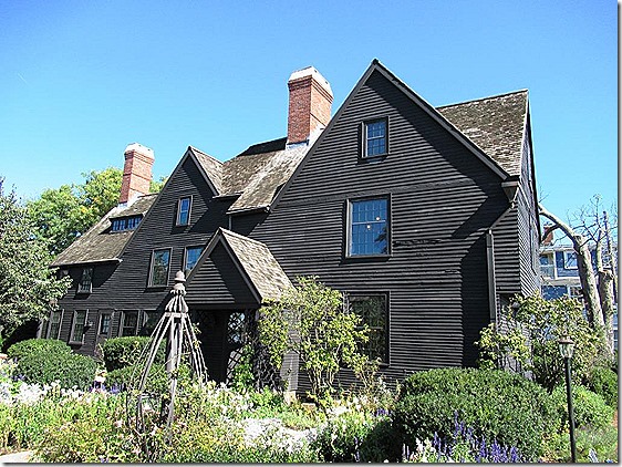
We continued on to Salem, MA, where we spent time sightseeing. Our first stop was The House of Seven Gables. Designated a National Historic Landmark District in 2007, The House of the Seven Gables is best known as the setting of world-renowned American author Nathaniel Hawthorne’s 1851 novel which bears the same name. The house which is located on Salem Harbor was built In 1668 by merchant and ship-owner John Turner.

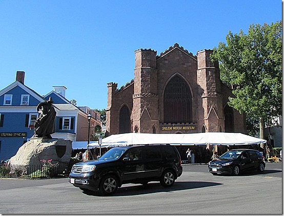
We took the guided tour through the house. We enjoyed learning about the history of the house, the additions – then parts that were taken down – then later rebuilt. It had a complicated history, but was remarkably restored. We were able to climb a secret stairway built into the chimney to the attic and back down another narrow passageway to the ground level. We weren’t allowed to take photos inside, but will remember the beauty of the Georgian architecture.After leaving the House of Seven Gables, we walked a few blocks to the Salem Common where they were having a “Food Truck” festival. Since it was lunch time, we all decided to try the famous "lobster rolls.” They were okay, and maybe it was because it was just a food truck lobster roll, but I don’t think I can be converted to becoming a lobster roll fan. I think I prefer my lobster hot with drawn butter to cold lobster mixed with mayonnaise and celery  and served on a grilled hot dog bun. Maybe I need to try it again … It was fun to walk around and see all the people and the large variety of food offerings.Just across the street from the Commons was the Salem Witch Museum which we had planned to tour. It is the Number 1 rated thing to see by TripAdvisor and all of the tour books so, of course, we all agreed we should go. What a disappointment! The historical information was interesting, but the presentation was poorly executed. We were all disappointed with the place and would not recommend the stop. Oh well …

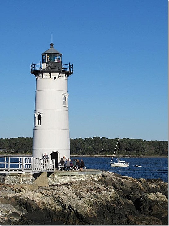
We continued north and made our way to Portsmouth, NH to see the lighthouse. The 48-foot tower of Portsmouth Harbor Light, built in 1877, overlooks the entrance to Portsmouth Harbor from historic Fort Constitution and the U.S. Coast Guard Station. The lighthouse tours are operated by volunteers and we were able to go up to the light and look out. From the shore, we were able to see the fifty-foot high Whaleback Lighthouse which sits in the middle of the Piscataqua River, at the entrance of the Portsmouth Harbor. It was interesting that the Portsmouth Lighthouse was originally taller than the Whaleback Lighthouse, but should have been shorter to indicate it is closer to shore. They built the current lighthouse inside the old one, then tore down the outside shell of the old one, leaving the remaining white lighthouse that stands today – 2 feet shorter than the Whaleback lighthouse!After our stop at the lighthouse, we continued to Kennebunkport, ME where we are spending the night at the King’s Port Inn. We walked to The Hurricane restaurant and had a lovely seafood dinner before returning back to the hotel. This is a view over the river. Tomorrow we will spend some time touring along Ocean Drive before continuing north. Who knows, we may even see some of the Bush family on our way!

Saturday, September 30, 2017

September 30, 2017 - Boston, MA

Everyone told us that is was going to rain today, but it was such a beautiful evening last night, we didn’t want to believe them. Well, everyone was right! We woke to rain, rain, and more rain.

We had breakfast in the hotel, then borrowed a couple of umbrellas from the front desk and headed out to sightsee and walk the Freedom Trail. Having taught middle school US History, I was excited to see the places where so many of our country’s significant historical events took place!

From our hotel we headed to Boston Common. Established in 1634, Boston Common is America’s oldest public park. Puritan colonists purchased the land rights to the Common’s 44 acres from the first settler of the area, Anglican minister William Blackstone. The pasture then became known as the "Common Land" and was used to graze local livestock until 1830. It was also referred to as a "trayning field," where over 1000 Redcoats made camp on the Common during the British occupation of Boston in 1775. It was from here that three brigades of Redcoats left to make the fateful trip to Lexington and Concord.

Adjacent to Boston Common, the next stop on the trail was the Massachusetts State House. Completed on January 11, 1798, and is widely acclaimed as one of the more magnificent public buildings in the country. The land for the State House was originally used as John Hancock’s cow pasture. The golden dome, was once made of wood, but was later overlaid with copper by Paul Revere. It was covered with 23-karat gold leaf for the first time in 1874 and was painted grey during World War II to protect the city from bombing attacks.Following the trail we made our way to the Old Granary Burying Ground on Tremont Street next to the Park Street Church. This historic cemetery is the final resting place of John Hancock, Samuel Adams, and Paul Revere, as well as Elizabeth Goose, believed to the the legendary “Mother Goose.”  We were fascinated by how many of the gravestones were adorned with winged figures or skulls and crossbones. Apparently, one of the most popular motifs was the "Soul Effigy," a skull or "death’s head" with a wing on each side that was a representation of the soul flying to heaven after death.The large memorial was erected for John Hancock, while Paul Revere’s was quite small.Continuing on, we stopped at King’s Chapel. Established in 1687, it was the first Anglican congregation in Boston and the first church in America to have a pipe organ.

Another stop along the Freedom Trail is the Old South Meeting House. Built in 1713 to house the colony’s government, the Old State House was at the center of civic events that sparked the American Revolution. It was here that on July 18, 1776, the Declaration of Independence was read for the first time to the public in Massachusetts from the balcony of the Old State House. We passed the site of the Boston Massacre and on to Faneuil Hall. It is often referred to as "the home of free speech" and the "Cradle of Liberty," Faneuil Hall hosted America's first Town Meeting. This is where the Sons of Liberty proclaimed their dissent against British Royal oppression. For more than 270 years it has continued to provide a forum for debate on the most consequential issues of the day. It was at Faneuil Hall in 1764 that Americans first protested against the Sugar Act and the Stamp Act, setting the doctrine that would come to be known as "no taxation without representation." Gatherings to protest the Townshend Acts, the Redcoat occupation, and the Tea Act would follow.

We found ourselves in the North End and stopped at a small restaurant for lunch. It was okay, but certainly not noteworthy!

We passed Paul Revere’s House and on to Old North Church which first opened on December 29, 1723. Its 191 foot steeple is the tallest in Boston and, because of its prominence, would play a dramatic role in the American Revolution. On April 18, 1775 Paul Revere met up with the sexton Robert Newman to tell him how to signal the advancement of British troops towards Lexington and Concord. Newman opened the church,climbed the stairs and ladders up eight stories to hang two lanterns for a few moments. It was long enough for patriots in Charlestown to learn what has been immortalized by the phrase "one if by land, two if by sea" in Longfellow’s poem. The British were advancing by boat across the Charles River.We stopped also at Copp’s Hill Burying Ground before ending our portion of the Freedom Trail. We did not continue on to the USS Constitution because it is closed for renovations. We meandered back to our hotel passing near the Charles River and enjoyed a brief period of no rain!Chinatown is located near our hotel and we checked out restaurants for dinner on the way!We ended our day at Pho Pasteur, a Vietnamese restaurant. Dinner was good and the company was great! Tomorrow we leave Boston and move north into Maine – and the weather forecast is SUNNY!

September 29, 2017 - Fort Collins, CO to Boston, MA

Today, we had an early morning start for a trip we have been planning for almost a year. We were on our way to meet friends, Marlies and Bernhard, from Germany, who would be touring in New England and invited us to join them.

We flew from Denver to Indianapolis then Boston. Marlies and Bernhard arrived about 30 minutes after we did, so we had good timing!

We used UBER to the Doubletree by Hilton on Washington Street. The drivers in Boston are a bit crazy, so we were thankful to have Bobby, who was a good driver!

After checking in, we walked to the South End and ended up at Stephi’s on Tremont. Tobey had the clam chowder and I ordered a pizza to for us to share. The food was good, but the restaurant was pretty noisy. I guess we aren’t used to “big-city” dining! We arrived back to the hotel around 10:30 pm and will do a walking tour of the city tomorrow.

Saturday, September 2, 2017

September 1-2, 2017 - Glacier NP to Fort Collins, CO

Homeward bound!

After saying our final goodbyes to Marcia and Phil, we were on our way back to Colorado while they continued their Montana adventures.

We left Glacier and headed north to catch Hwy 464 east back to Browning, Montana and then on to Great Falls. Tobey commented that it was amazing that we covered the same distance back to Great Falls in about three hours – the same distance that took them three days!

When we got back to Fairfield, we both commented on how many silos and elevators are in the town. It does boast that it is the malting barley capitol of the world. The population is only about 700 people, but they have over 130,000 acres of cropland in production for raising malt barley in the area.2017 - 9 - 1 Fairfiekd silosWe also went by several fields where the farmers were cutting wheat/hay. Coming into Lavina on Highway 12, we both commented on this building. Tobey said boarding house, I thought hotel. After getting home, I checked it out and it was a hotel. It is actually listed in the National Register of Historic Places. It was built in 1908 to provide accommodation for railroad travelers in the area. Apparently, it is believed to also have two ghostly residents!Coming into Billings we spotted this old car that was tricked out. The owner seemed to be having fun!From Billings we headed into Wyoming and made a stop at the Little Bighorn Battlefield. We watched the 20 minute film at the visitor’s center which did a great job reenacting the battle which took place on June 28, 1876, and the results. The visitor’s center has a nice museum inside with artifacts recovered from the area, both Native American and from the Custer and the 7th Calvary unit. I wish I had visited here when I was still teaching history!

We walked up the hill to the Last Stand Hill to see the 7th Calvary Memorial. After the battle, Lakota and Cheyenne families removed their dead – approximately 60-100 warriors. After the Native Americans left, the US Army hastily buried their dead in the field where they fell. The markers in the field show where those soldiers were originally buried.Later, the remains of 11 officers and two civilians were transferred to eastern cemeteries. In 1881, the remains of approximately 220 soldiers were reinterred in a mass grave around the base of the memorial.In 2013, the Indian Memorial was competed. It is circular in design and has a “spirit gate” window where you can look back and see the Calvary Memorial. The spirit gate welcomes the departed Calvary soldiers into the memorial circle. We were impressed with how well done the entire memorial is done, honoring both the Native Americans and the US 7th Calvary.

We continued on our homeward journey. The smoke in the sky continues to make impressive sunsets.We stayed overnight in Kaycee, Wyoming at the city park. They offer free overnight camping for up to five days. It was a nice little park, but dark when we arrived at 9:30. We got a shot of our RV in the morning before taking off.

We hoped we had left the haze and smoke behind by the time we got to Colorado, but it wasn’t to be! Traveling south on I-25, we could still see the haze in the air from all of the fires in the western part of the US. Apparently, it has been hazy here for the last three days, too!

If you would like to check out Tobey’s ride, this is a link showing the ride and camping stops. The official ride was 385.4 miles, not including our “rest” day in Great Falls and sightseeing on the bikes for fun.

https://ridewithgps.com/routes/23079418

We got home about 2:00 pm after a great trip. We’re getting things put away and laundry done, then will need to do a few minor repairs on the RV. In the meantime, Tobey is trying to find a bicycling partner to do a cross-country trip next!