

Not far down the trail, they hit the low point in elevation, only 436 feet!

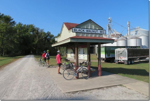
The Black Walnut terminal was just 9.5 miles down the road and the eastern terminus of the trail was at Machens, just another 3.5 miles.


Machens is the “official” eastern end of the Katy Trail, but not the end of the ride for the day. They rode on a gravel road for a ways, then paved on their way to the Grafton Ferry to cross over into Illinois.

They caught the ferry and headed on to Illinois.


Rider and bike were $4.00 one way. Tobey and Phil were about the only ones wearing masks.

The lighthouse greeted them as they got off the ferry in Grafton, along with some fun sculptures!


They also spotted a blue heron on shore.

Marcia and I would not meet up with the guys until we got to Chautauqua near noon. We went on Hwy 94 and slowed down to let this guy finish crossing the road. He looked more like a swamp creature than a turtle!


As we got closer to the Mississippi we could see the bridge which we would cross to get to East Alton.

Machens is the “official” eastern end of the Katy Trail, but not the end of the ride for the day. They rode on a gravel road for a ways, then paved on their way to the Grafton Ferry to cross over into Illinois.
They caught the ferry and headed on to Illinois.
Rider and bike were $4.00 one way. Tobey and Phil were about the only ones wearing masks.
The lighthouse greeted them as they got off the ferry in Grafton, along with some fun sculptures!
They also spotted a blue heron on shore.
Marcia and I would not meet up with the guys until we got to Chautauqua near noon. We went on Hwy 94 and slowed down to let this guy finish crossing the road. He looked more like a swamp creature than a turtle!
As we got closer to the Mississippi we could see the bridge which we would cross to get to East Alton.
Marcia and I stopped to see the Piasa bird on the way to Chautauqua and the guys stopped on their way south. Googlemaps directed us through the town and down a one-way street that was so narrow we barely fit – and it said authorized vehicles only. I decided we were “authorized” and we went! We made it down to the parking lot and there was an easy entrance off the river road! Ugh. Anyway, Tobey said he could have sworn the Piasa Bird painting was bigger – but of course, he was a kid when he used to go there!


There were some caves near the painting, but they were from mining operations and fenced off to prevent people from going in.

There were some caves near the painting, but they were from mining operations and fenced off to prevent people from going in.
We met in Chautauqua where Tobey’s grandparents had a vacation home when he was a kid. The lighthouse stands on the road to mark the entrance.

Chautaqua communities were founded all across the United States in the late 1800s and focused on education, religion, and recreation.

Chautaqua communities were founded all across the United States in the late 1800s and focused on education, religion, and recreation.
We walked all around letting Tobey relive his childhood memories. This is the church.

There is a huge auditorium/theatre where the have plays and performances. He remembers that they showed movies there when he was growing up.


Below is the house that belonged to his grandparents. We met the man in the house just behind it to the right and visited with him for a while. His parents owned the house he is now in and he remembered his grandparents, as well as Tobey’s Great-Aunt Ruth and her husband, Gene.

A few trees were starting to change color and it was a welcome treat to see.

This water feature was built in the late 1960s but was new to Tobey. It was dedicated to a resident’s wife.

After the trip down memory lane, we needed to get the guys back on their bikes for the final part of their ride today. We headed straight back to East Alton, and they made their stops at the Piasa Bird and views along the Mississippi.

The bluffs stand tall next to the river. They had to ride on the river road’s bike path for part of the way before joining back to a dedicated bike/walking trail.

These were a couple of the buildings as we came into Alton.


We are parked at the Argosy Casino for the night. The ride today was 39.5 miles, with a .5 float across the Mississippi!

One more day of riding tomorrow!


.jfif)


.JPG)


