Travel with Tobey and Sue

Travel with Tobey and Sue
Tobey and Sue in Africa

Thursday, September 26, 2013

September 22, 2013 - September 23, 2013 Lead and Deadwood to Fort Collins

Another beautiful start to the day … even though it was windy. We knew we wanted to take a hike and see what Lead was like, so we stopped at the Homestake Visitors’ Center in Lead to get some information about the area. WOW!

According to the Center, “The times of "fabulous fortunes" were sensational, wild, perhaps wicked and short lived. The actual Deadwood/Lead gold rush began in 1875 and ended in 1877. Yet, gold was to play a huge role in the area’s history, economy, and development for many, many years to come.”

Near the end of the Black Hills gold rush, George Hearst purchased one of the claims in the area and incorporated it as the Homestake Mining Company which operated for 126 years – until 2002. Homestake was the oldest, largest and deepest mine in the Western Hemisphere, reaching more than 8000 feet below the town of Lead. Mining operations included both underground and surface operations. The historic 1876 open cut mining area was amazing to see.

We also stopped at the Interpretative Trail to see part of the original equipment used in the mining operation.

From Lead, we headed a few miles past Deadwood to hike up Mt. Roosevelt, upon the recommendation of the visitors’ center. The hike was an easy one – only about two miles round trip and not very strenuous, but the views were amazing!

We could see to Spearfish and Belle Fourche, plus the Bear Lodge Mountains in Wyoming, and views of the plains all the way to North Dakota. From other parts of the trail we could see Bear Butte, Terry Peak, Custer Peak, Harney Peak and the cities of Lead, the Homestake Open Pit Mine, and Deadwood.

In 1919 Deadwood’s sheriff, Seth Bullock, built the Mount Roosevelt Friendship Tower in dedication to his close friendship to President Theodore Roosevelt. It was also meant to be a memorial of both Bullock and Roosevelt’s love of the wide open spaces they both loved. We climbed to the top of the 31 foot tower which now has a roof covering the overlook platform. The views were stunning!

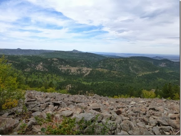
We continued back down the trail and got a good view of Bear Butte to the east, as well as several rock fields.
Back in Deadwood, we stopped at the Adams Museum which, in 1930, was a gift to the City of Deadwood. Deadwood businessman and former mayor W.E. Adams built the Adams Museum as a tribute to Black Hills pioneers and in memory of his deceased first wife and two daughters.The museum houses an incredible collection of artifacts and memorabilia from powerful legends of Wild Bill, Calamity Jane and Deadwood Dick. There is also a large collection of Lakota bead and quill work and Potato Creek Johnny’s gold nugget.


The guys participated in a friendly poker tournament in the afternoon while Ann and I relaxed and read back at the RVs.

The weather changed – again – later in the evening. Rain began about 9 pm and continued ALL night into Monday.

We had intended to get an early start and go to Devil’s Tower on our drive home, but the forecast was more rain, so we packed up and headed back to Colorado. The fog and clouds hung low and made for a sloppy drive.

After noon the sky started to clear as we were heading south through Wyoming.

By the time we arrived back in Fort Collins the sun was shining and the sky was clear. It was a fun trip, but it’s good to be home!


Wednesday, September 25, 2013

September 21, 2013 - Rapid City to Deadwood, South Dakota

Today we moved from Hart Ranch, south of Rapid City to the Creekside Campground, near Deadwood. The drive was beautiful and we stopped at the Pactola Dam and Reservoir overlook. Pactola Lake is the largest reservoir in the Black Hills.
After setting up at Creekside, we drove into Deadwood and toured the Mt. Moriah Cemetery – The Black Hills Boothill. Mt. Moriah was established in 1878 and is the burial spot for figures like Wild Bill Hickok and Calamity Jane. Hickok, a legendary figure even in his own lifetime, was shot in the back of the head by Jack McCall, while playing poker at the No. 10 Saloon on August 2, 1876.
Calamity Jane who is renowned for her excellent marksmanship, preference for men's clothing, and bawdy behavior is buried next to Hickok.

We even hiked to the very top of the cemetery where Sheriff Seth Bullock is buried, overlooking the town of Deadwood.

The Days of ’76 began as a way to honor Deadwood’s first pioneers - the prospectors, miners, muleskinners and madams who poured into the Black Hills in 1876 to settle the gold-filled gulches of Dakota Territory. Since the first celebration in 1924, the Days of ‘76 has grown into a legendary annual event with a historic parade and an award-winning PRCA rodeo. We went to the Days of 76 Museum which highlights that history. It was well done and we spent hours reading the history, looking at the artifacts, pictures, and memorabilia and archives generated by the celebration.

We strolled through Deadwood and checked out some of the historic buildings, as well as some of the casinos. Can’t say that we are big spenders … I spent my $5 and called it a day!
We shared dinner back at our camp and spent the evening playing cards and board games.

September 20, 2013 - Mount Rushmore Memorial, Cathedral Spires Hike

Today the weather was fantastic! We were up and on our way by 8:30 this morning. First stop was Mount Rushmore. We took the 1/2 mile “Presidential Trail” hike to get a closer look at the mountain carving. It was interesting to have views of one face at a time along the trail. We stopped at the Sculptor’s Studio where a park ranger was giving a talk about Borglum and his work on the mountain.
Tobey graciously agreed to pose for the fifth face on the mountain!
We decided to come back tonight to go through the museum and the lighting ceremony because we wanted to take a couple hikes while the weather was good!

On our way back to the Cathedral Spires trailhead, we spotted these mountain goats along the road. Our wildlife list just keeps growing!

We stopped for a picnic lunch then arrived at Cathedral Spires. We were off … the trail was rated as difficult, but didn’t seem as bad as most Colorado hikes. We did have to scramble up some areas that were mostly boulders that was probably the hardest part.


The hike is about 3 miles roundtrip and is not a loop – it just deadends!


There was a group of climbers in one section of the spires that we stopped to watch for a while. They were brave!

We headed back to Sylvan Lake and walked the one mile loop around the lake. Enormous granite formations line portions of the lake making it one of the most picturesque in the Black Hills.

The path circles the lake and is cut through the granite to bring us back around.

On the way back to camp we stopped off at the Prairie Berry Winery for their free wine tasting. FUN! We had spotted their signs and stopped at a liquor store to ask what winery we should visit and they recommended Prairie Berry because they make all of their own wines. It was lots of fun and we ended up buying their red ass rhubarb wine to take home. http://www.prairieberry.com/

After dinner at camp, we headed back to the Mount Rushmore Memorial for the evening lighting ceremony and to tour the museum. The park ranger gave an inspirational program which included a talk about her favorite president, Thomas Jefferson, a film Freedom: America’s Lasting Legacy, and the lighting ceremony. After the ceremony, servicemen, active and retired, were invited onto the stage for the retiring of the flag. It was awe inspiring!

We enjoyed spending time in the museum looking at the historical pictures and reading about the construction. Built between 1927 and 1941, the cost of construction was $989,992.32! It was also interesting to find out why this memorial was built and why these four presidents were selected. You can check out more information about Mount Rushmore on the park service website. http://www.nps.gov/moru/index.htm


September 19, 2013 - Keystone, SD, Custer State Park

This morning was chilly and windy, but we got an early start and headed out to take the historic walking tour of Keystone. Most of the original buildings are gone, but the town has done a really good job of plaques with pictures and descriptions of the area back in the 1880s and 90s.

The original log school house was built in the early 1890s. According to the signs, Miss Mary Wheelock taught 40 students here in 1894-1895! I can’t imagine where they all sat! In 1899, the Keystone School was built in Victorian architecture, at a cost of $10,000 for 300 students. It served as a schoolhouse until 1988. Now the building is home to the Keystone Historical Museum, but closes for the winter in September.
From Keystone we continued south along the Iron Mountain Road to Custer State Park.

Known for its “pigtail” bridges, Iron Mountain Road redefined what a road could be. Between the entrance of Mount Rushmore and Custer State Park, we traveled over 17 miles of the stacked loops of wooden bridges and through one-lane tunnels that perfectly frame Mount Rushmore.

Designed by Cecil Cylde Gideon in 1932, many people felt cutting a road through the area could not be done. Riding horseback, CC Gideon and Senator Norbeck spent long hours laying out the Iron Mountain Road, the tunnels that frame Mount Rushmore, and these bridges. These bridge surfaces are neither straight, level, nor flat, and the log work has great variation in quality. Logs were selected from nearby, cut to fit, seasoned, then put in place. They are a true testament of engineering determination and vision!
Such care was taken not to disturb the landscape that some sections of the road actually divide into one-lane one-way ribbons that swoop and bound through mixed pine and deciduous forest. This is a postcard I bought that shows the unique design of this highway!

We stopped to take a picture looking back at Mount Rushmore through one of the one-lane tunnels along the road.

After a picnic lunch, we continued south to drive the “Wildlife Loop Road” in the park. We stopped at the historic Wildlife Station Visitor Center to find the best place to spot bison. The building was originally built as the Buffalo Herdsman's house and over the years has housed the herdsman and other park staff, but more recently became a Visitor Center around 1990. The building was constructed with the unique craftsmanship of the CCC era. It houses exhibits, wildlife mounts, and a bookstore. With our “bison directions” in hand, we continued another six miles down the road where much of the approximate 1000 head-herd is already being moved for the winter.
Ann and I hopped into the back end of their truck so we could have a better view of the herd. We watched in amazement as other tourists were out of their vehicles, taking pictures of the bison, despite the warning signs that these are dangerous animals!
We took video of several bulls chasing a female across the fields, across the road, and around the truck. There is no way I would want to be standing out in the road when they went zooming by! http://youtu.be/Xq1flsK9D7g and http://youtu.be/QZR1mQ_Lcp4

After 45 minutes of watching these huge beasts, we continued on the loop. Another five or six miles down the road we came upon the wild burros. The burros are not native to the park; they are feral animals that are descended from burros (donkeys) that were once used to transport people up to the top of Harney Peak (also in the park). After the trips were discontinued, the burros were released in the park. Thus, they became semi-wild to wild animals that have passed down the skill of begging for handouts from the many cars that travel the road.
They seem to hang out along/on an area of the road that has a pull off area.


Okay, so I had to get out and pet them … they were quite friendly!

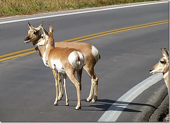
A little further down the road, we saw several pronghorn on the hill. This one paused long enough to pose for a picture
!

Gary gave me a bad time because I wanted to stop to see “Prairie Dog Town,” an area where the prairie dogs gather. He kept reminding me that they are really rodents. I don’t care. Prairie dogs are named for their habitat and warning call, which sounds similar to a dog's bark and it was fun for me!

Not to disappoint, we passed a small herd of mountain sheep walking along the road shortly before the Mount Coolidge Lookout.

We could actually see Mount Rushmore and Crazy Horse behind us using quite a bit of camera zoom!

After Mount Coolidge we continued north onto the 14 mile stretch of Needles Highway. It passes through pine and spruce forests, meadows surrounded by aspen and birch trees, and rugged granite mountains. The road's name comes from the needle-like granite formations which seem to pierce the horizon along the highway. Many of these formations are 50 to 100 feet above the highway and rounding each switchback is a new set of unique rocks to view.


The roadway was carefully planned by former South Dakota Governor Peter Norbeck, who marked the entire course on foot and by horseback. Construction was completed in 1922. Because the tunnel is so narrow, we had to pull the mirrors in on Gary’s truck so we didn’t scrape the sides!

We had one more wildlife sighting before we got back to Hill City for dinner. There was a flock of wild turkeys along the road.

We arrived back into Hill City about 4:30 and went to the Alpine Inn for dinner. Ann and Gary had been there years ago, and we were happy with their suggestion. The dinner menu is limited – you have a choice of a 6 ounce or 9 ounce bacon-wrapped Filet Mignon served with a salad and baked potato. It was delicious!!!
http://www.alpineinnhillcity.com/sidebar-dinner.php


After stuffing ourselves, we headed back to camp for a relaxing evening of cards.